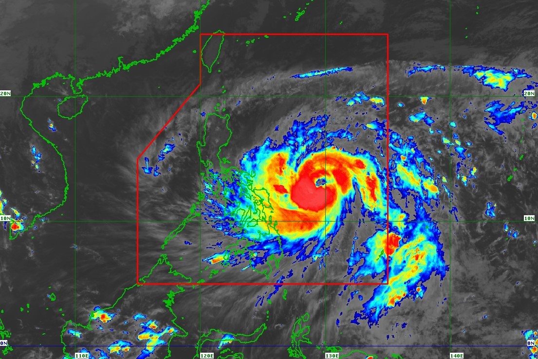

MANILA, Philippines — Typhoon Uwan (international name: Fung-Wong) has intensified further as it moves closer to the Philippine landmass, bringing the threat of strong winds, heavy rains, and dangerous storm surges across parts of Luzon and the Visayas, according to the Philippine Atmospheric, Geophysical and Astronomical Services Administration (PAGASA).
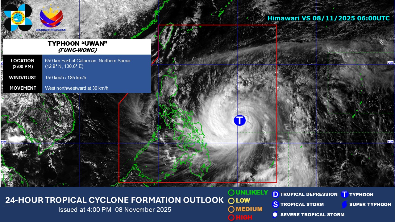
As of 10 a.m. Saturday, November 8, the eye of Typhoon Uwan was located about 680 kilometers east of Borongan City, Eastern Samar. It was packing maximum sustained winds of 140 kilometers per hour near the center, with gusts reaching up to 170 kilometers per hour, and moving westward at 35 kilometers per hour. PAGASA said the typhoon’s wind circulation is extensive, with gale-force winds stretching hundreds of kilometers from its center.
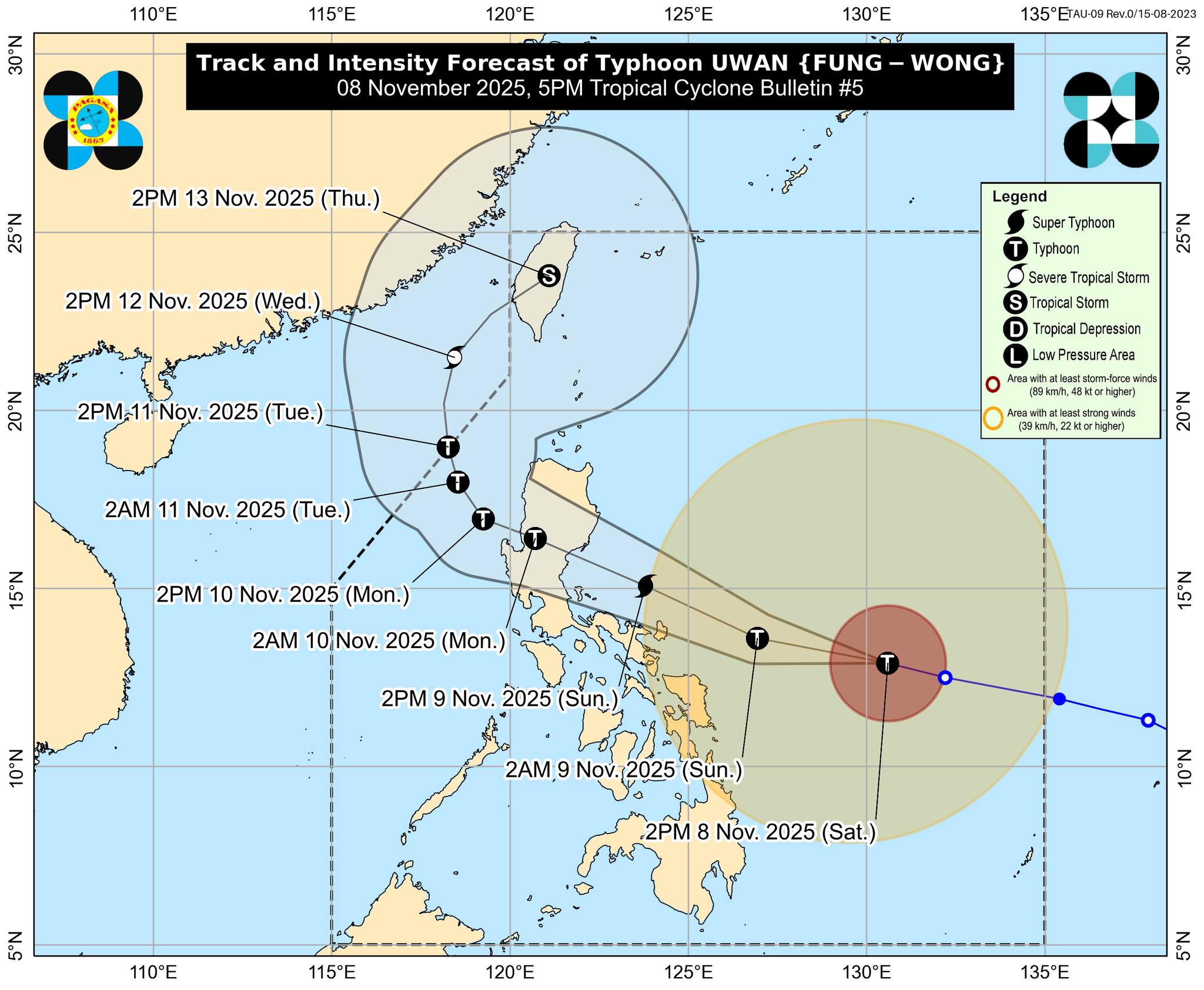
The weather bureau warned that Uwan is expected to continue strengthening and may reach super typhoon status before making landfall. Based on the latest forecast track, the system could pass near Catanduanes by Sunday morning, November 9, before making landfall over the southern portion of Isabela or northern Aurora late Sunday or early Monday. Once it crosses northern Luzon’s rugged terrain, Uwan is likely to weaken but remain at typhoon strength while traversing the region.
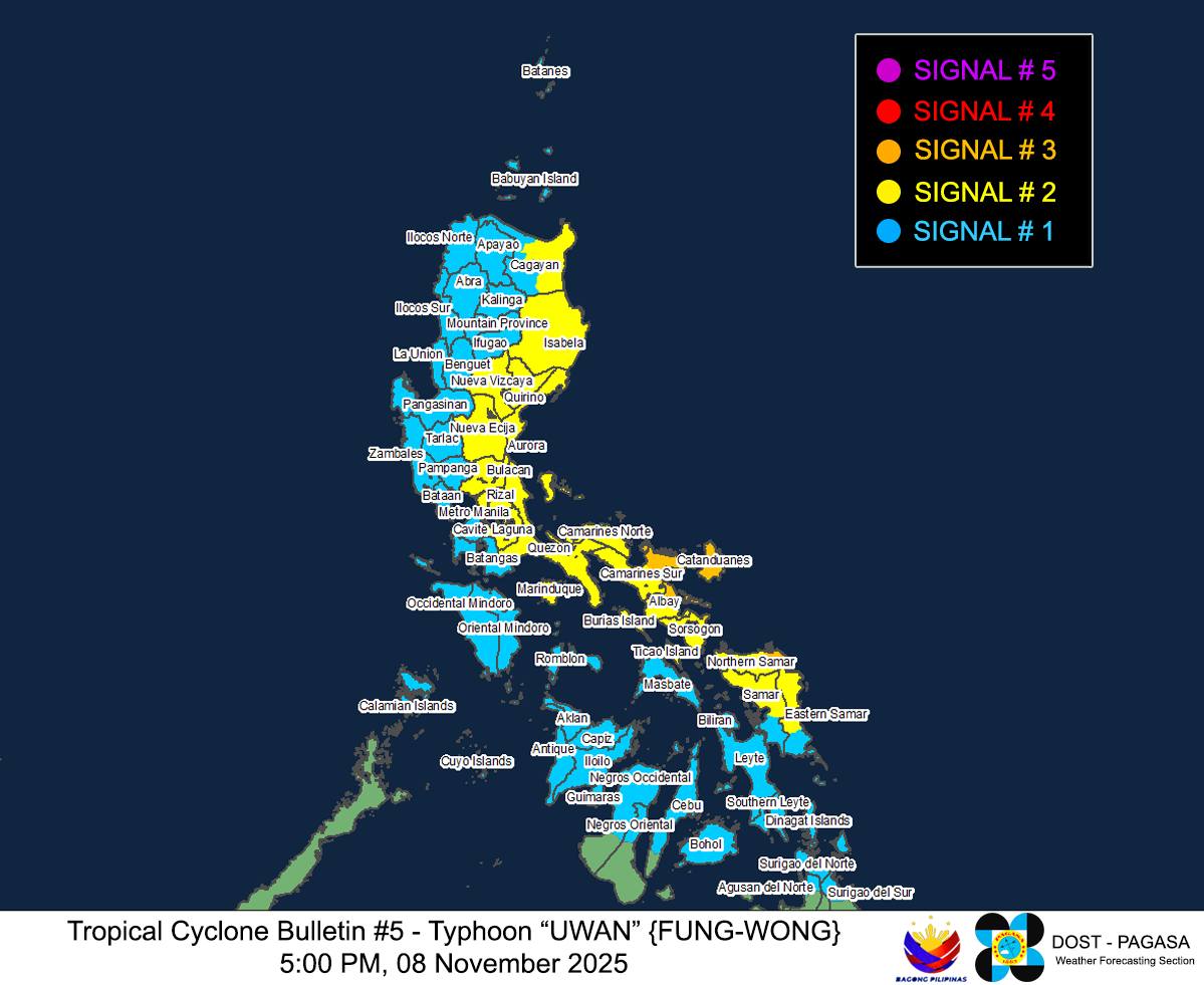
With its expansive circulation, PAGASA has raised Tropical Cyclone Wind Signal No. 2 over several areas in Luzon and the Visayas. Coastal communities in these regions have been urged to brace for possible storm surges that could reach up to three meters, especially along the eastern seaboards of Northern and Central Luzon, the Bicol Region, and parts of the Visayas.
The agency also warned of very rough to extremely rough seas, particularly along the eastern coastlines of Catanduanes and nearby provinces, where wave heights could reach as high as 14 meters. Fisherfolk and operators of small vessels are strongly advised to stay ashore until conditions improve.
Aside from the destructive winds, Typhoon Uwan is expected to bring intense rainfall that could trigger flash floods and landslides, even in areas outside the direct path of the storm. PAGASA advised residents in low-lying and mountainous areas to be on high alert and prepare for possible evacuations.
Local disaster risk reduction offices have been placed on standby as authorities coordinate preemptive measures, including the suspension of sea travel and preparations for emergency response in at-risk communities.
PAGASA reminded the public to stay vigilant and closely monitor weather bulletins as Typhoon Uwan continues its approach. “Residents, particularly those living in coastal and flood-prone areas, should take all necessary precautions,” the agency said.
As the country braces for Uwan’s impact, officials urged Filipinos to secure their homes, prepare emergency supplies, and follow the guidance of local authorities to ensure safety in the coming days.